
Planning guides
Hiking in Adjara, Georgia: trails, season and trailheads (2026 guide)
Updated 10 October 202627 min readPrices and facts checked: September 2026
Adjara's marked hikes are in three free national parks 28 to 58 km from Batumi and in the Khulo mountains 86 to 122 km inland, from Village Tago to Skhalta, Khikhani fortress and Goderdzi. The season up high is June to mid-October; here is how to reach each trailhead, what it costs in 2026 and where to sleep.
On this page+
- Where can you hike in Adjara, and which half of the region suits you?
- Which Adjara hikes start within an hour of Batumi?
- Which Adjara hikes can you do from Batumi without a car?
- What do the three national parks actually offer a walker?
- Which hikes start up in the Khulo mountains?
- Is there a long-distance trail in Adjara?
- Which Adjara trails are actually marked, and which need a downloaded track?
- When is the hiking season in Adjara, month by month?
- How do you reach each trailhead from Batumi?
- What does hiking in Adjara cost in 2026?
- Do you need a guide in Adjara, and what does one cost?
- Do you need a border permit, and what about bears and shepherd dogs?
- Where do you sleep between hikes in mountainous Adjara?
- Where can you camp or sleep out on a route?
- What should you pack for an Adjara hike?
- Which Adjara walks work with children?
- Questions people ask
Map of the places in this guide
Zoom with + and - or by pinching. Click the map first to zoom with the mouse wheel.
- 1Mtirala National Park
- 2Machakhela National Park Administration and Visitor Center
- 3Gonio Cross
- 4Kapnistavi Waterfalls
- 5Waterfall Mirveti
- 6Makhuntseti Waterfall
- 7Kintrishi Nature Reserve
- 8Tbikeli Lake
- 9Glamping Tago
- 10Skhalta Monastery
- 11Khikhani Fortress
- 12Shuamta Big Lake
- 13Goderdzis Ugheltekhili
- 14Green Lake
- 15Goderdzi Alpine Garden
- 16ბეშუმი
- 17bus station
- 18Cable car station
- 19Khulo Tourist Information Center
- 20Take and Hike | Outdoor, Sport, Ski equipment, Hiking tours | T&H
- 21Sakhva Travel
- 22Veloman Extreme Georgia
- 23Rima's Village Home
- 24Guest House Khikhani
- 25Homestay Vardtsikhe
- 26Hotel Ambassadori Goderdzi
- 27Mtirala House
- 28Eco House Merisi Hotel and Restaurant
- Batumi to Khulo by car · 86.2 km
- Khulo to Village Tago by 4x4 · 8.6 km
- Khulo to the Goderdzi pass by car · 30.2 km
- Village Tago to Skhalta monastery on foot · 7.5 km
Adjara has two kinds of hiking. On the coast behind Batumi, three protected areas (Mtirala, Machakhela and Kintrishi) have marked forest trails from 260 m up to 2,200 m, 40 to 90 minutes from Batumi by car. Up in the Khulo mountains, the walks start between 900 m and 2,000 m: the marked path from Village Tago down to Skhalta monastery, the Shuamta lakes and Khikhani fortress on the Turkish border, and the meadows of the Goderdzi pass above Green Lake.
This guide covers both halves: which trails are really marked, how you reach each trailhead from Batumi without a car, what the season looks like month by month, what a guide costs in 2026, where to sleep, and the permit you need for Khikhani.
Where can you hike in Adjara, and which half of the region suits you?
Pick the coast if you are based in Batumi for a day or two and want rainforest, waterfalls and a trail you can reach by city bus. Pick the mountains if you want views, alpine lakes and more than one day of walking, and plan at least two nights inland, because the good walks start 86 to 120 km from Batumi.
| Coast: the three parks | Mountains: Khulo and Goderdzi | |
|---|---|---|
| Altitude of the walks | 260 to 1,250 m (Tbikeli 2,222 m) | 900 to 2,236 m |
| Drive from Batumi | 28 to 58 km, 40 to 90 minutes | 86 to 122 km, 2 to 4 hours |
| Season | May to October; waterfalls April to October | June to mid-October |
| Marked trails | 2 in Mtirala, 2 in Machakhela, 2 in Kintrishi | Tago to Skhalta, Khikhadziri to Shuamta and Khikhani, the alpine route |
| Ground | Wet forest, mud, ticks, very few views | Meadows, ridges, fog in the afternoon |
| Sleeping | Batumi, or a guesthouse at the park | Glamping Tago, guesthouses in Khulo, Khikhadziri, Goderdzi |
Adjara's official route register on Visit Ajara holds 23 routes, but most of them are drives. Only two carry the type "Hiking", four are 4x4 routes and one is a cycle route; 16 are marked and 7 are not. The walks below are the ones you can follow on foot, with the marking stated for each.
Which Adjara hikes start within an hour of Batumi?
Four walks: the Tsablnari trail in Mtirala National Park (28 km from Batumi), the Mtavarangelozi trail in Machakhela (about 31 km), the Gonio Cross above Gonio (13 km) and the waterfall walks at Kapnistavi and Mirveti (26 to 27 km). All of them work as a half day.
Mtirala National Park: the rainforest trails
Mtirala is 15,580 hectares of Colchic rainforest above Chakvi and part of the UNESCO Colchic Rainforests and Wetlands site since 2021. It takes up to 4,500 mm of rain a year, so the paths are muddy even in August. Entry is free, and the visitor centre at Chakvistavi is 28.4 km from Batumi, about an hour by car.
- Tsablnari trail: 7 km circular, easy, between 265 and 442 m. The Tsablnari waterfall is 2 km in, with a camping area beside it. Near the start a hand-pulled cable cabin takes you over the river. With a swim in the small lake and a break, count on about 4 hours.
- Tsivtskaro trail: 16 km circular over two days, from 260 m up to 1,250 m, June to September, with a tourist shelter for 8 people at the 9th kilometre. The return half is overgrown and hard to follow, so most walkers go out and back to the shelter.
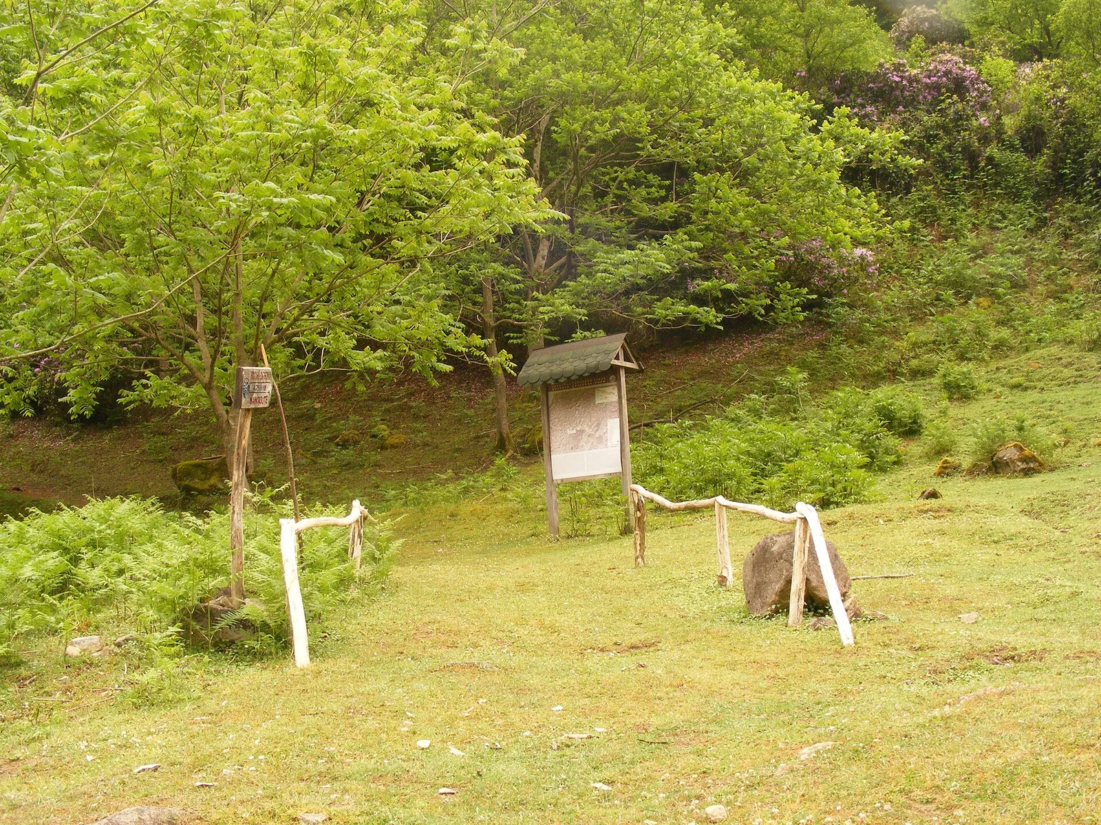
Pets, smoking, fishing and hunting are not allowed in the park, and fires only at the marked sites. Mobile coverage is partial, so download the map before you leave Batumi.
Machakhela National Park: the quiet valley on the Turkish border
Machakhela is 8,733 hectares of forest along the Machakhela river, established in 2012, with no gate and free entry. It has two marked trails and neither is short, so it suits walkers rather than families after a stroll.
- Mtavarangelozi (Archangel) trail: 9 km, about 4 hours, medium. It starts in the village of Sindieti, 24 km from Batumi, with 5 km on a track to the last house, then a footpath through beech and chestnut forest to the summit, which looks over Batumi and the gorge.
- Kokoleti trail: 15 km, about 6 hours, medium: 9 km by vehicle from the visitor centre to the last house in Kokoleti, then 6 km on foot to a viewpoint over the six villages of Upper Machakhela in Turkiye. It runs in the state border zone: contact the park administration at least 10 working days before you walk it.
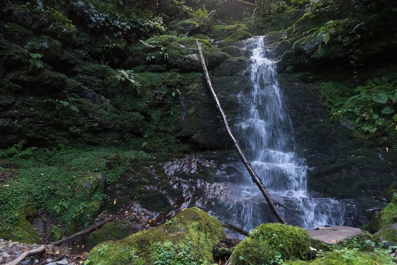
The Twins waterfall, two identical streams side by side, is about 50 m high at 735 m. Pets are not allowed in the park.
Gonio Cross: the car-free climb above the sea
The concrete cross on the hill above Gonio, 13 km south of Batumi, is the best short hike you can reach by city bus. It is 5.5 km and about 2 hours up from Gonio with about 330 m of climb, then 3.8 km and about an hour down to Agvia. Much of it is paved village road with one forest section of loose rock and sand.
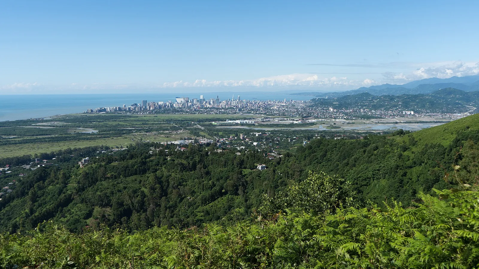
Take bus 16 from Batumi towards Sarpi (every 17 minutes, 06:40 to 23:06, 30 tetri with a Batumi transport card) and get off after the fortress, by the Rompetrol station. There are no barriers at the cliff edge at the top.
Kapnistavi and Mirveti: waterfall walks for a half day
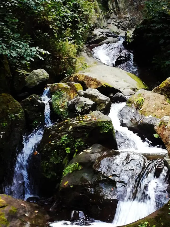
Kapnistavi has seven waterfalls in one valley, 26 km from Batumi, the highest 35 m. The first fall is a 5 minute walk from the car park, over footbridges past old mills, and at the lower fall you can stand behind the curtain of water. Two 2026 reviews mention pressure to buy at a wine cellar on the path, so keep to the path and walk on.
Mirveti is 27 km from Batumi at 60 m on the Chorokhi river. The 20 m fall is a 30 minute walk through a protected alley of Colchic boxwood, with a medieval arch bridge near the confluence.
Which Adjara hikes can you do from Batumi without a car?
Gonio Cross is a city bus ride. Mtirala, Machakhela, Kintrishi and Khulo all have public transport, but it thins out after the morning, so start early and know the last van back.
- Mtirala: minibus 40 leaves the Batumi shopping centre on Aghmashenebeli Street for Chakvi about every 6 minutes, and bus 13 every 30 minutes (park page). From the park sign in Chakvi it is 15 km up a narrow road: a taxi from Chakvi is 20 to 30 GEL one way or 50 to 60 GEL there and back, and a taxi straight from Batumi 80 to 100 GEL, or 120 to 150 GEL with a 3-hour wait and the ride back. A rural bus runs from the old Batumi bus station to Chakvistavi on Monday and Friday only, in the morning and at 17:50, for 3 GEL, and minibuses to Khala at 08:30, 11:30, 14:30 and 17:50 (1 GEL) leave you 7 km short.
- Machakhela: marshrutkas leave the Batumi farmers market at 08:00 (Chikuneti, school days only), 12:00 (Adjara Sariati), 12:30 (Zeda Chkhutuneti) and 14:00 (Chikuneti), per the park's own timetable.
- Kintrishi: minibus from Batumi to Kobuleti every 10 to 15 minutes for 1.50 GEL, then 40 minutes on to Chakhati and 8 km on foot to the visitor centre (park page). Above Tskhemvani you need an off-road car.
- Makhuntseti waterfall: the Keda marshrutka (77) from the old bus station passes it, about 30 km out.
- Khulo and the mountains: marshrutkas every 30 minutes, 08:00 to 20:00, about 10 GEL (see the transport section below).
Makhuntseti is the one Adjara waterfall on a bus line, which is why it is crowded and ringed by souvenir stalls. It sits just off the Khulo road and adds about 4 km to that drive.
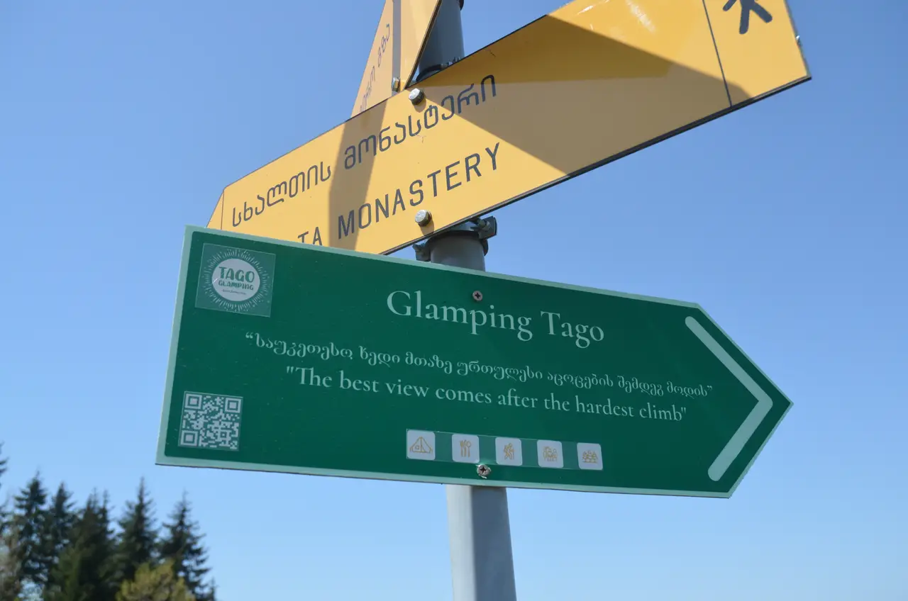
Staying in the Adjara mountains? See the glamping in Tago village
What do the three national parks actually offer a walker?
Two marked trails each, free entry, and paid extras at the visitor centres. Mtirala has the shortest walk and the most facilities, Machakhela the quietest forest, and Kintrishi the only alpine lake of the three.
| Mtirala | Machakhela | Kintrishi | |
|---|---|---|---|
| Marked trails | Tsablnari 7 km, Tsivtskaro 16 km | Mtavarangelozi 9 km, Kokoleti 15 km | Tamar bridge day walk, Yew and Tbikeli 2 days |
| Altitude | 260 to 1,250 m | averages 300 to 350 m | 300 to 2,500 m |
| From Batumi | 28 km | about 30 km | 49 km to Tskhemvani |
| Visitor centre | Chakvistavi | Acharisaghmarti, Mon-Fri 09:00-18:00, weekends 10:00-18:00 | Tskhemvani |
| Shelter | 8 beds at km 9, 20 GEL a person | none | 6 beds at Tskhemvani, 15 GEL a person |
| Border permit | no | Kokoleti trail only | no |
| Season | May to October | May to October | Tbikeli route April to November |
Kintrishi: the two-day walk to Lake Tbikeli
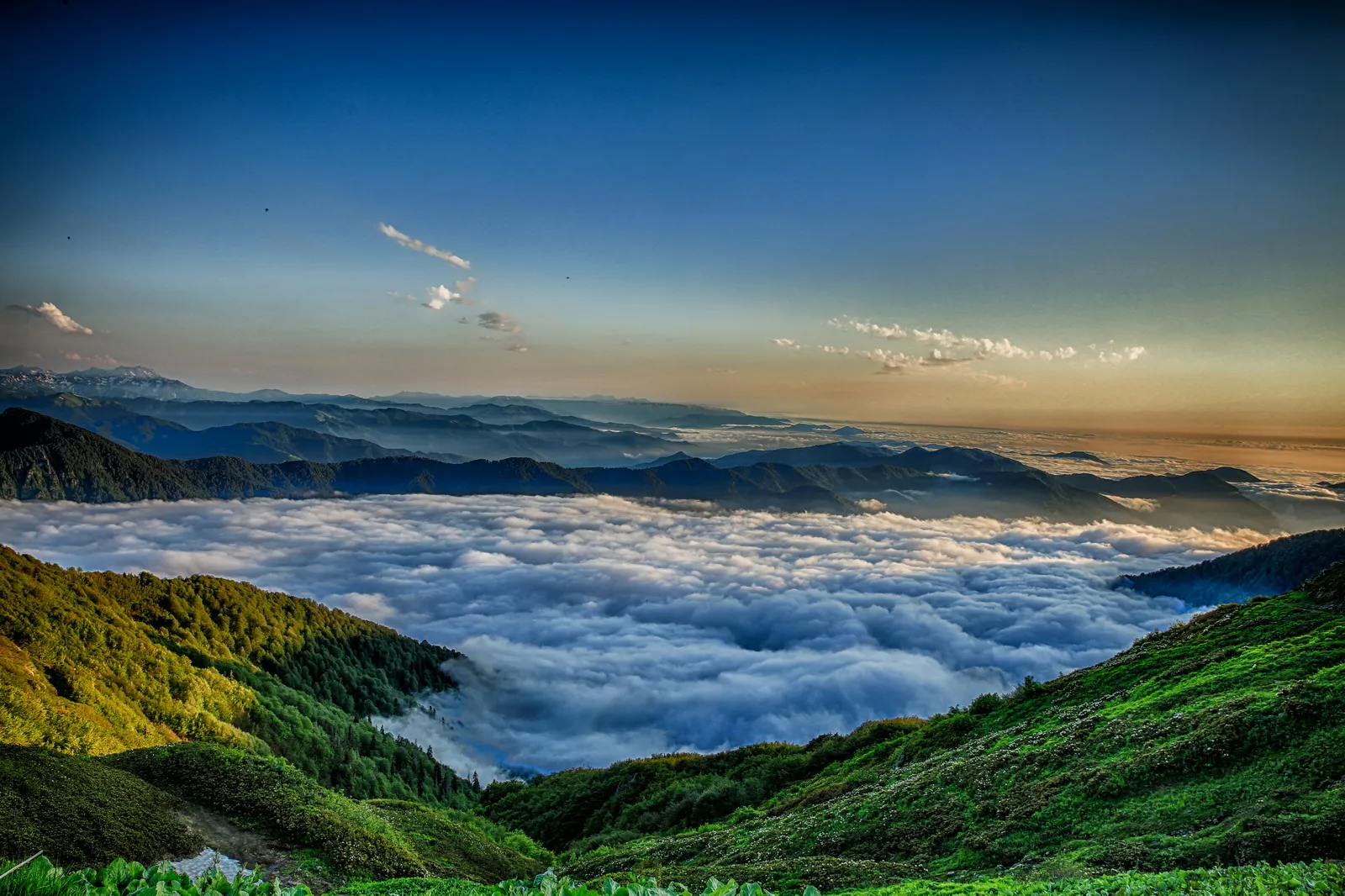
Kintrishi runs from 300 m to 2,500 m in the gorge above Kobuleti; the reserve dates from 1959 and became a national park in 2019. The one-day route crosses the Tamar arch bridge and the box-tree stands and is walkable all year. The two-day Yew and Lake Tbikeli route is 37 km from the Tskhemvani visitor shelter, open April to November, on foot or on horseback; the last 12 km run from the ruined Khinotsminda church to the lake.
Lake Tbikeli lies at 2,222 m on Mount Nabadziri, 8 to 10 m deep, home to the endangered Caucasian newt. As a day hike from Khino it is a hard one: 23 km there and back with 1,760 m of climbing, 10 to 12 hours, and most of the Kintrishi valley has no phone signal. Tskhemvani to Khino is off-road only, so book the car with the park.
Which hikes start up in the Khulo mountains?
Four areas, each a different trip: the walks from Village Tago above Khulo, the Uchkho waterfall below Khulo, the Shuamta lakes and Khikhani fortress from Khikhadziri, and the Goderdzi pass with Green Lake and Beshumi. They are not on one road, so plan them as separate days.
From the gate of Glamping Tago: five documented walks
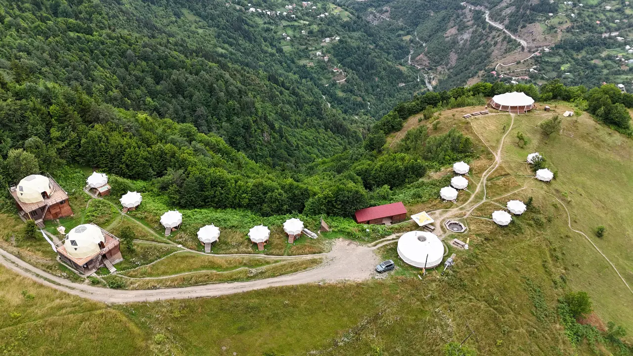
We run Glamping Tago on the ridge above Village Tago, 8.6 km of 4x4 road above Khulo. Five walks leave from the camp itself, and we publish the track, the climb and the grade of each on our hiking page. Walk them yourself for free, or book one of our hiking guides on the hiking page.
| Walk | Distance | Time | Climb | Grade |
|---|---|---|---|---|
| Village walk | 2.2 km | 2 hours | 119 m | easy |
| The Lonely Tree | 3.6 km loop | 2 hours | 131 m | easy |
| The Green Hill | 4.5 km | 2 hours | 126 m | easy |
| Otsinari lake | 4.1-4.4 km each way | 4-6 hours | about 597 m | medium |
| Skhalta monastery | 8.4 km each way | 4-6 hours | 607 m | medium |
The village walk passes a spring you can drink from, a small waterfall and the photo rock. The Lonely Tree loop gives the best view of the camp. The Green Hill is the first half of the Skhalta route, through a fern field to a picnic hilltop.
Otsinari lake sits at about 1,450 m on Mount Otsinari, above the camp. It fills with snowmelt and shrinks through the summer, so swimming is realistic only until the end of June. The first 30 minutes are steep and turn to mud after rain, and bears live in these woods, so do not walk it alone.
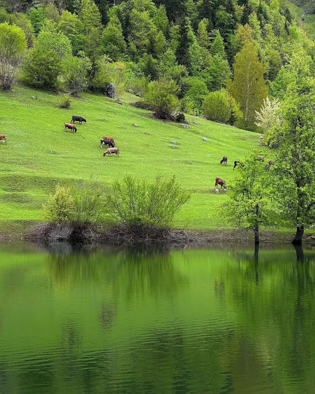
Tago to Skhalta monastery: the marked walk down the valley
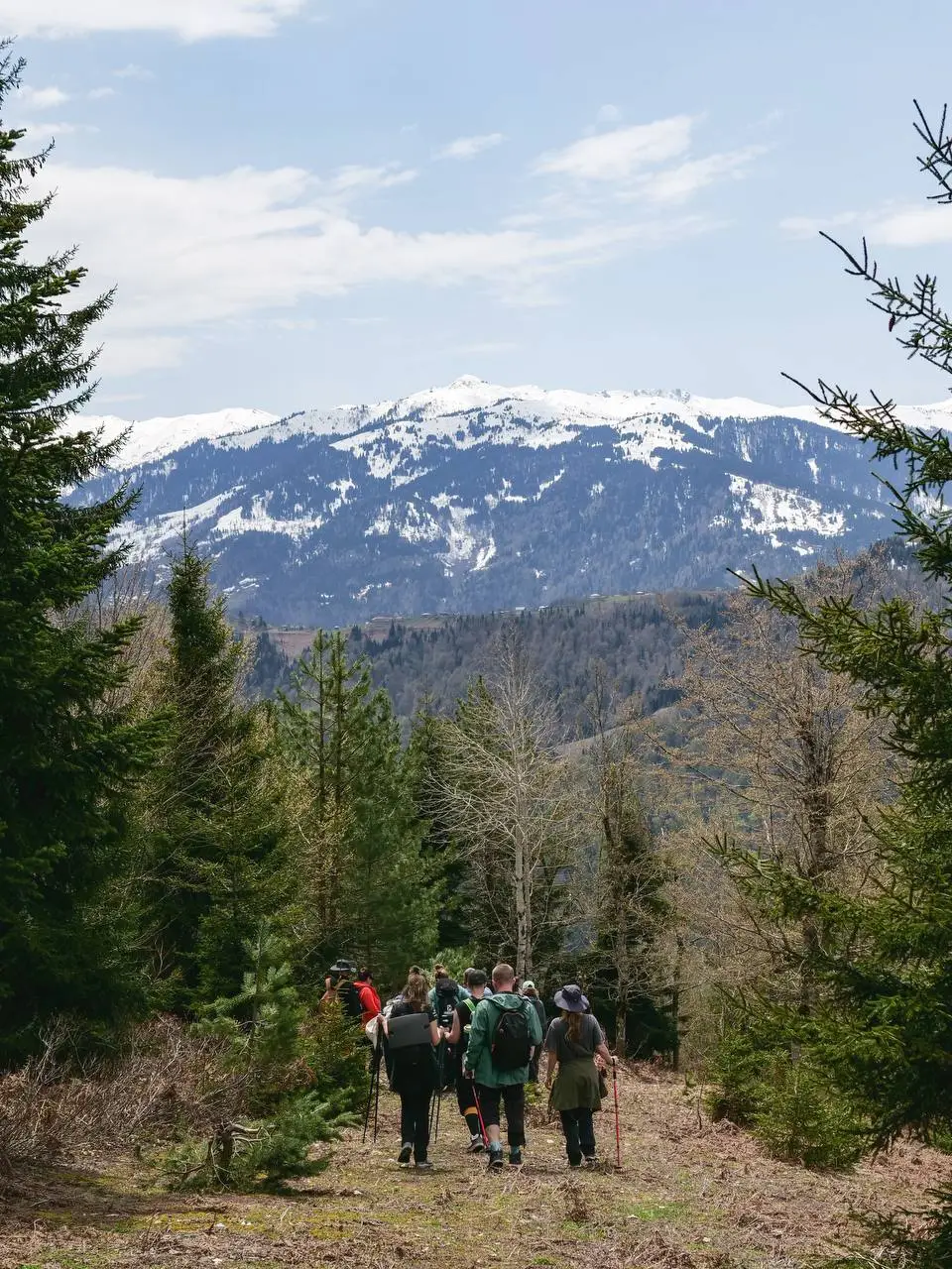
The path to Skhalta monastery is the best-marked walk in the Khulo mountains. It leaves the upper exit of Glamping Tago and follows yellow markers all the way; the official route page confirms the whole route is marked and signposted. You have phone signal throughout, a spring to drink at and a shop for snacks near the end.
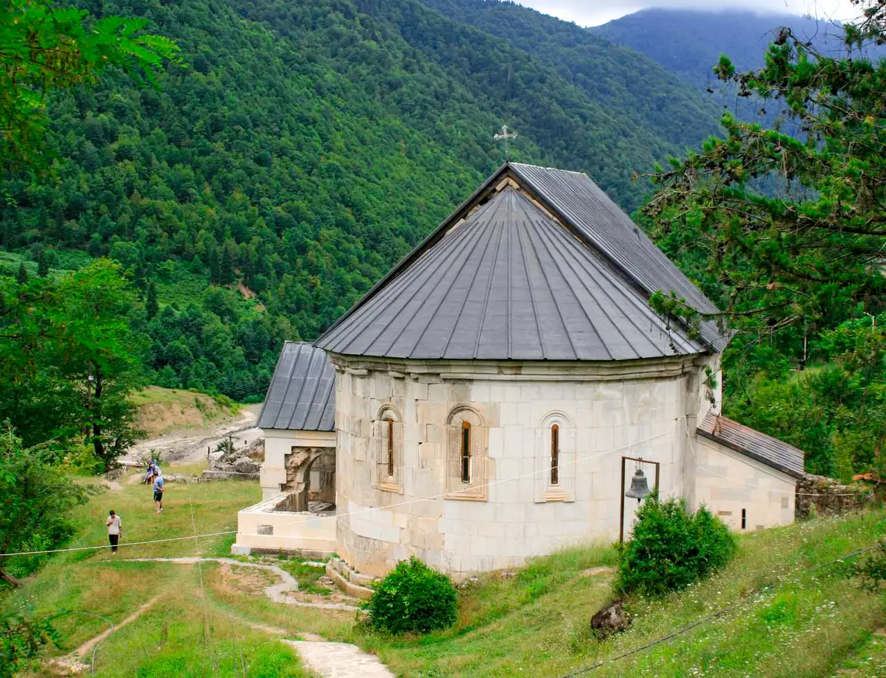
It is downhill out and uphill home. One way is 8.4 km with 607 m of descent to the monastery at 714 m. Walk back the same way, or loop home through Cheri and Dzmagula: 15.6 km in all with 705 m of climbing. If you do not want the climb back, walk down and book our taxi for the return before you set out, or catch the marshrutka from Skhalta to Batumi at 09:00 or 15:00 for 5 GEL. Strong walkers can make a full-day loop over Otsinari lake and Mount Argineti: 18.8 km with 1,277 m of climbing.
The monastery church dates from the 13th century and its wall paintings from the 14th to 15th. The Skhalta walk is not recommended in winter because of deep snow.
Uchkho waterfall from Khulo
The official Khulo to Uchkho route is 10 km and marked: 6.8 km of asphalt from Khulo to Uchkho village, 600 m more of asphalt, 2 km of dirt road to the last house (better in a 4x4), then a forest path to the first fall, 17 m high. There is no path to the second and third falls, and the only drinking water is in the village.
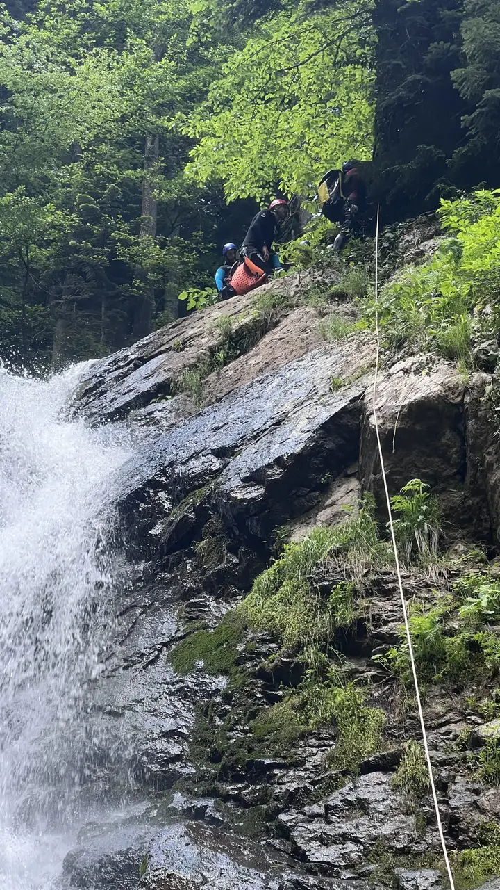
Below the falls the river drops through the Uchkho canyon. Our canyoning day abseils down ten of its drops and swims the pools between them, with certified canyon guides and all the equipment; you need no experience.
Khikhani fortress and the Shuamta lakes from Khikhadziri
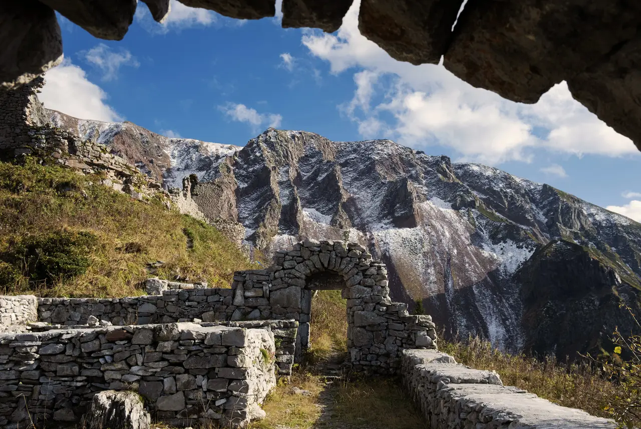
Khikhani fortress stands at 2,216 m above Khikhadziri, the highest point of official route 35. That route is a marked 33 km loop in one long day: 13.3 km up to the Shuamta lakes, 7 km across to Khikhani and 12.6 km back down to Khikhadziri. Most walkers do only the fortress: about 8 km in total with about 600 m of climbing from the road head, per Take and Hike, which runs it as a group day from Batumi for 160 GEL a person.
The last 1.5 km climbs 400 to 420 m on a narrow stony path fitted with at least a dozen metal staircases. 2026 walkers took between 1 hour 20 and 3 hours to get up. The route page advises against the climb for people with heart or breathing problems.
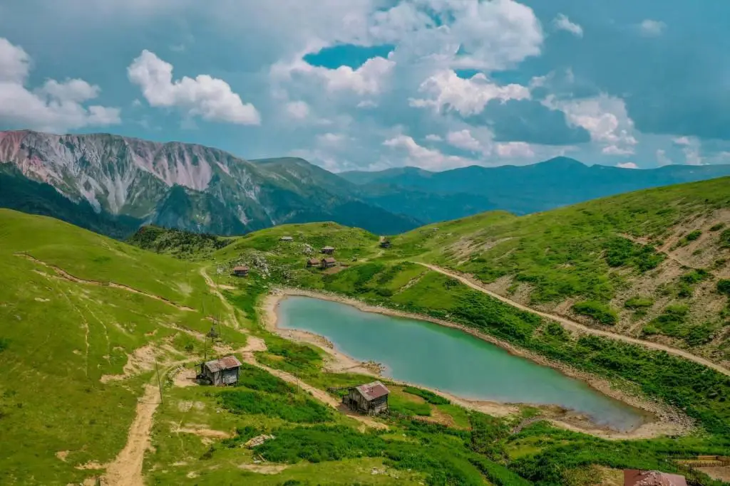
The fortress needs a border permit; the Shuamta lakes do not, if you take the marked bypass on the official map (see the permit section below). The Shuamta lakes are five lakes at about 2,150 m, best from June to September.
Khikhadziri is about 38 km from Khulo and about 107 km from Batumi, so this is a two-day trip from the coast: drive on day one, sleep in a guesthouse, walk on day two. Skhalta monastery sits on that road and costs no detour. From Glamping Tago the Khikhani car park is 36.4 km, about 77 minutes on mountain roads. A marshrutka leaves Batumi for Khikhadziri at 10:00 for 7 GEL and returns at 09:00.
Goderdzi pass, Green Lake and Beshumi
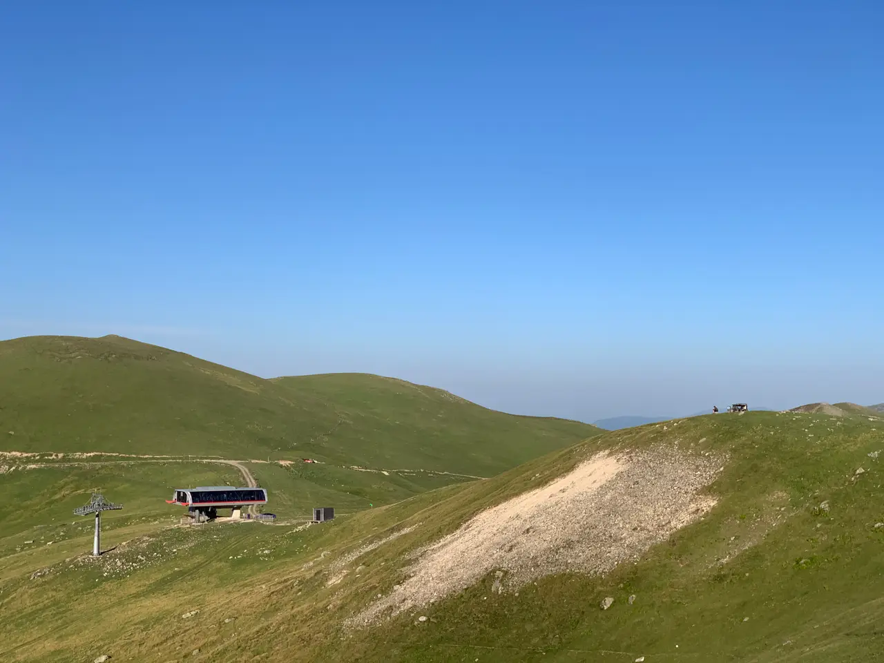
The Goderdzi pass (2,025 m) is the trailhead for Adjara's easiest high walking: open meadows, a paved side road and three destinations within 8 km. It is 30 km above Khulo on a road that is asphalt almost all the way: a few kilometres near Bodzauri were still unfinished in summer 2026, and a normal car handles them in dry weather. Local drivers allow about 1 hour 30 for it.
| From the pass on foot | Distance | Altitude |
|---|---|---|
| Green Lake | 7.8 km | 2,058 m |
| Beshumi | 6.2 km | 1,943 m |
| Goderdzi Alpine Botanical Garden | 2.5 km | 1,941 m |
| Beshumi to Green Lake | 13.9 km | |
| Alpine Garden to Green Lake | 10.3 km | |
| Khikhani fortress to Beshumi | 13.4 km |
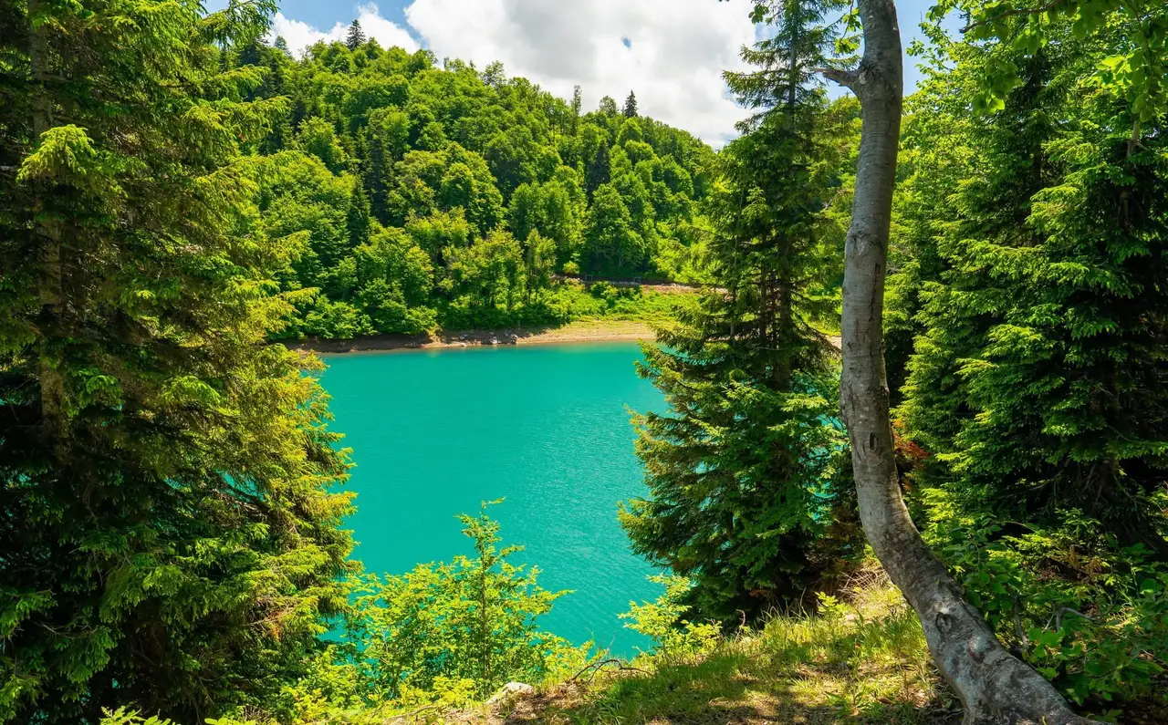
Green Lake is free, has no gate and no closing time, and reaches 19.4 m at its deepest; our Green Lake guide covers it in full. Beshumi and Green Lake sit on opposite sides of the pass, not next to each other.
The Alpine Botanical Garden, run by the Batumi Botanical Garden, is 9.6 hectares of wild alpine plants beside the road, open 09:00 to 20:00 and best from 15 May to 15 October, with a picnic area and an equipped camping area.
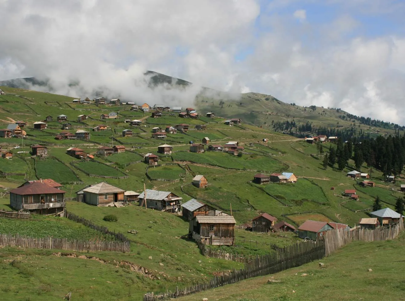
Beshumi is a summer settlement of wooden cottages at 1,850 to 2,000 m, empty outside June to September. The Shuamtoba highland festival, with horse races and wrestling, falls on the first weekend of August.
Is there a long-distance trail in Adjara?
There is one marked multi-day route. The Alpine Route Chirukhi-Khikhadziri-Goderdzi is 70 km over three days, from the Chirukhi plateau (92 km from Batumi) through the summer pastures past Lake Karagoli and the Shuamta lakes to Khikhani, ending at the Goderdzi pass by Green Lake.
The Adjara tourism agency walked a 45 km version of it as a hiking festival in July 2024: Chirukhi to the Sarichairi pasture (9-10 km, camping at about 2,145 m), on towards Khikhani (13-14 km), up to the fortress and the Shuamta lakes (3-4 km), and down to the Alpine Garden (11.5 km). The whole route stays between 1,800 and 2,236 m, and day two passes a border post, so carry the permit and your passport.
The Transcaucasian Trail does not cross Adjara; its Georgian sections are in Samtskhe-Javakheti, Imereti, Racha and Svaneti.
Which Adjara trails are actually marked, and which need a downloaded track?
Marked on the ground: the two trails in each national park, Tago to Skhalta, Khulo to Uchkho, route 35 to Shuamta and Khikhani, and the Chirukhi alpine route. Everything above 2,300 m is unmarked.
Adjara's high summits have no marked paths, signs or facilities. Kanli mountain (2,987 m, on the Turkish border) is the example: climbable only from late June through September, a 4x4 to reach the approach valleys from Khulo, a full day on foot, and a downloaded GPS track. The seven unmarked routes in the official register are the same story: go with a guide.
When is the hiking season in Adjara, month by month?
June to mid-October in the mountains, May to October on the coast. July and August are the surest months up high; September is the best balance of weather, colour and quiet trails.
| Month | Khulo (875 m) high / low | Mountains (1,800-2,200 m) | Coast parks |
|---|---|---|---|
| April | 12 / 3 C | Snow on the pass, closed | Waterfalls at full flow, trails wet |
| May | Snow patches, pass mostly closed | Park season opens | |
| June | Opens; lingering snow, mud, fog | Good | |
| July | 22 / 13 C | Best: pastures occupied, flowers out | Hot and humid |
| August | 23 / 13 C | Best, clearest month | Hot and humid, ticks in grass |
| September | 20 / 9 C | Good, shepherds coming down | Good, birdwatching at Mtirala |
| October | 15 / 5 C | Early month only; rain peaks | Last month |
| November | 9 / 0 C | Snow, pass closed | Off season |
Khulo averages are from WeatherSpark. Temperature falls about 0.7 C per 100 m of climb, so the Goderdzi pass is about 8 C colder than Khulo. Snow lies at the pass from about November to May; in Khulo itself the snowy period runs from mid-October to late April. Glamping Tago is open from 1 April to the end of October.
How do you reach each trailhead from Batumi?
Everything leaves from Batumi. The mountain marshrutkas go from the old bus station at 1 Mayakovsky Street; the city buses to Chakvi and Gonio from the centre.
| Trailhead | From Batumi | By car | Public transport |
|---|---|---|---|
| Gonio Cross | 13 km | short city drive | Bus 16, every 17 minutes |
| Mtirala, Chakvistavi | 28 km | about 1 hour | Minibus 40 to Chakvi, then taxi |
| Machakhela visitor centre | about 30 km | about 45 minutes | Marshrutkas from the farmers market |
| Kintrishi, Tskhemvani | 49 km | about 1.5 hours | Minibus to Kobuleti, then Chakhati |
| Khulo | 86 km | about 2 hours | Marshrutka every 30 minutes, about 10 GEL |
| Village Tago (Glamping Tago) | 95 km | 2.5 to 3 hours | Marshrutka to Khulo, then 4x4 taxi |
| Khikhadziri (Shuamta, Khikhani) | 107 km | 2 hours to Khulo, then 37 km of mountain road | Marshrutka 10:00, 7 GEL |
| Goderdzi pass | 116 km | 3.5 hours | Marshrutka to Khulo, shared car 11:00 |
| Beshumi | 122 km | about 3 hours 45 | Marshrutka 08:50, 15 GEL, summer |
Batumi to Khulo: marshrutkas every 30 minutes from 08:00 to 20:00, about 10 GEL, 2 to 2.5 hours for 86 km of asphalt (our transport page). The sign in the window reads ბათუმი - ხულო. Coming back, the vans pick up near the Khulo cable car station at 07:30 and 18:30 (Batumi to Khulo guide). A taxi app ride is up to 175 GEL.
Khulo to Village Tago: the Khulo-Tago cable car has been closed for reconstruction since 2024 and has no reopening date, although several official pages still send walkers to it. The way up is our 4x4 taxi: 75 GEL per car for up to 4 people, 30 to 35 minutes, from the cable car station in Khulo. Walking up takes 2 to 3 hours, all uphill, on a path that starts from the stairs in Khulo.
Khulo to Goderdzi: a shared car leaves the Khulo tourist information centre at 11:00 and returns from Goderdzi at 16:00 for 7 GEL; a local car is 20 to 30 GEL. The Beshumi marshrutka leaves Batumi at 08:50 in summer for 15 GEL and returns from Beshumi at 09:00, 10:00, 11:00 and 12:00; from Khulo a minibus runs to Beshumi between 09:00 and 16:00 for 6 GEL (Visit Ajara).
From Kutaisi airport: a train (2 hours, 31 GEL) or a bus (2 hours, 25 GEL) runs four times a day to Batumi, and a marshrutka from Kutaisi bus station takes 3 hours for 20 GEL.
What does hiking in Adjara cost in 2026?
The trails are free. You pay for transport, a guide if you want one, and the extras in the parks.
2026 prices
| What | Price | Where |
|---|---|---|
| Entry to Mtirala, Machakhela, Kintrishi | Free | All three parks |
| Tourist shelter, Mtirala | 20 GEL a person | Agency of Protected Areas |
| Tourist shelter, Kintrishi | 15 GEL a person (10 for students) | Agency of Protected Areas |
| Tent / sleeping bag rental | 10 / 5 GEL | All three parks (mat 3 GEL at Machakhela and Kintrishi) |
| Campsite | 5 GEL a person | All three parks |
| Horse | 50 GEL a day | Mtirala |
| Zip-line, Mtirala | 15 GEL | Visitor centre (rope park 15 to 20 GEL) |
| Cable cabin over the river, Mtirala | 2 GEL | Triplinkhub |
| Bus 16 to Gonio | 30 tetri | Batumi transport card |
| Marshrutka Batumi to Khulo | about 10 GEL | Old bus station |
| Marshrutka Batumi to Beshumi | 15 GEL | 08:50, summer |
| Marshrutka Batumi to Khikhadziri | 7 GEL | 10:00 |
| Minibus Khulo to Beshumi | 6 GEL | 09:00-16:00, in season |
| Taxi Chakvi to the Mtirala visitor centre | 20 to 30 GEL one way, 50 to 60 GEL return | Chakvi |
| Taxi Batumi to Mtirala | 80 to 100 GEL | GoBatumi |
| 4x4 taxi Khulo to Village Tago | 75 GEL per car, up to 4 | Glamping Tago |
| Local guide from Glamping Tago | 150 GEL half day, 200 GEL full day | /hiking |
| Forest and herb walk with a herbalist | from 50 GEL a person | /activities |
| Group day to Khikhani fortress | 160 GEL a person | Take and Hike |
| Guided 2-day trek to Lake Tbikeli | 410 GEL a person | Take and Hike |
| Private mountain day with 4WD | from 220 GEL a person | Sakhva Travel |
| Guided walk at Goderdzi | 270 GEL a person | Ambassadori Goderdzi |
Do you need a guide in Adjara, and what does one cost?
Not on the marked trails: Tsablnari, Mtavarangelozi, Tago to Skhalta, Gonio Cross and the Goderdzi walks are all fine alone with a map app. A guide is worth it for the Tbikeli lake, the unmarked summits, Otsinari lake (bears) and any border-zone route.
Across Georgia a hiking guide costs 80 to 150 GEL a day, and mountain guides from about 300 GEL. The Mtirala park publishes four local guides for its long trail on the Tsivtskaro trail page. In the mountains, our guide from Glamping Tago is 150 GEL for a half day and 200 GEL for a full day, per group.
Take and Hike is Batumi's hiking club and outdoor shop at 27 Tbel Abuseridze Street, open daily 11:00 to 20:00. It runs scheduled group days into Adjara, such as Khikhani and Lake Tbikeli, and rents hiking gear; ask in the shop for rental prices.
Sakhva Travel runs private days with an English-speaking guide and a 4WD for up to 7 people, from 220 GEL a person with hotel pickup in Batumi.
Veloman Extreme Georgia in Batumi rents mountain bikes and outdoor gear, daily 11:00 to 20:00: the fallback when you need poles or a bike for the Goderdzi circuit.
Do you need a border permit, and what about bears and shepherd dogs?
You need a permit for Khikhani fortress, the Kokoleti trail in Machakhela and the other routes along the Turkish border. Apply before the trip, not at the trailhead. Bears live in all three parks and the Khulo forests but avoid people; shepherd dogs are the more likely encounter in summer.
The permit. The Border Police of Georgia issue entry permits for the border zone. The group leader emails the entry permit request with the start and finish of the route and scanned passports of every walker to bpol@mia.gov.ge, or files it at 12 Kandelaki Street in Tbilisi or at a regional Border Police division (Visit Ajara on border routes). The official list of Adjara routes that need it: Koslitavi-Goma, Didvake-Nakonaghvari, Khikhani fortress, and the Shuamta lakes from the Khikhani side (getting around). For Kokoleti, the Machakhela park arranges it. Carry your passport: the Khikhani path passes a checkpoint.
Bears. Camera traps have recorded brown bears and wolves in all three protected areas. Make ordinary noise in thick forest, mist and berry patches, keep food sealed and away from the tent, and never run (Caucasus Trekking on bears). Walk the Otsinari and Tsivtskaro routes in company.
Shepherd dogs. Never walk through a flock. Look for the shepherd and pass with him, or go around the flock uphill; keep a dog at a distance with a trekking pole, and bend as if to pick up a stone, a gesture the dogs know (Transcaucasian Trail advice).
Ticks. Ticks live in the long grass of the forest trails, Machakhela included, from spring to autumn. Check yourself after the walk. The emergency number is 112.
Where do you sleep between hikes in mountainous Adjara?
Sleep at the trailhead: at Glamping Tago for the Tago, Skhalta and Otsinari walks (and an hour's drive to Green Lake or Khikhani), in Khikhadziri for Khikhani and the Shuamta lakes, and at the pass for Goderdzi. On the coast, Batumi works as a base; these two places sit at the parks.
Glamping Tago, Village Tago (our place)
Twelve Lotus Belle tents and a nine-bed dome dormitory on the ridge, up to 33 people, with three vegetarian meals a day in Yurtalicious, our yurt restaurant, a wood-fired sauna that is free for staying guests, and five walks from the gate. In the village next to us, seven families keep 27 rooms for 64 guests, three to ten minutes on foot, booked through us (village guesthouses). Prices change with the date: today's prices.
Rima's Village Home, Vashlovani
Five rooms and 12 beds at 970 m in the Vashlovani valley near Khulo, three meals a day, check-in from 14:00.
Guest House Khikhani, Khikhadziri
The closest bed to the Khikhani and Shuamta trailhead: 6 rooms and 16 beds at 1,300 m, 25 to 80 GEL, hosting since 2014 and Good Host certified in 2025. The family runs guided walks and Adjarian cooking classes. If it is full, Homestay Vardtsikhe in the same village has 6 rooms and 15 beds at 50 to 70 GEL.
Hotel Ambassadori Goderdzi
The full-service hotel at the pass, with its own list of guided walks, e-bike and horse trips, and the summer lifts next door.
Mtirala House, Khala
Rooms, studios and a wooden house in Khala on the road to Mtirala, from 22 USD a night.
Eco House Merisi, Keda
Glass cottages with panoramic hot tubs in Merisi, about 50 km from Batumi, with its own restaurant: a comfortable base for the Keda valley, halfway to the mountains.
Where can you camp or sleep out on a route?
Adjara has exactly three official tourist shelters: Jvarimindori in Shuakhevi, the Kintrishi shelter and the Mtirala shelter (Visit Ajara register). Book the park shelters through the visitor centres before you go.
Camping is allowed at the park campsites (5 GEL a person), at the Alpine Botanical Garden, at the Goderdzi pass, at Green Lake and at Beshumi. Tago is on the official register as a free picnic and camping area; the camp spots in the village gardens next to Glamping Tago are arranged through reception.
What should you pack for an Adjara hike?
Shoes with a non-slip rubber sole are the one thing you cannot do without; on the Mtirala trails and the Otsinari climb, waterproof boots are better. Then a rain jacket, warm layers for the pass, and water for the day.
- Footwear: trekking shoes are enough for the easy walks and Gonio Cross; take boots for Mtirala, Tbikeli and anything above 2,000 m.
- Poles: useful on the Skhalta climb home and the Khikhani stairs, and against shepherd dogs.
- Rain gear and spare socks: Mtirala takes up to 4,520 mm of rain a year, and fog comes in fast on every high route.
- Water: fill up at the camp tap or the village springs; on Khikhani the only water is at the car park.
- Cash: cash only above Khulo and at the Mtirala river crossing.
- Passport: for any border-zone route.
- Offline maps: Organic Maps or MAPS.ME with the area downloaded; mobile signal is patchy away from the villages.
Which Adjara walks work with children?
The village walk, the Lonely Tree and the Green Hill from Glamping Tago (2 hours each, 119 to 131 m of climbing), the first fall at Kapnistavi, Mirveti, the Alpine Botanical Garden, and, for children used to climbing, the first 2 km of the Tsablnari trail to the waterfall. Machakhela has no short family trail, and the Khikhani stairs are for older children only.
Glamping Tago for this
Glamping Tago as your hiking base in the Khulo mountains
Five documented walks start at our gate, from the 2.2 km village walk to the yellow-marked path down to Skhalta monastery and the climb to Otsinari lake. Reception lends maps, matches a route to your group and books the taxi back up from Skhalta if you would rather not climb home.
Walk on your own for free, or take a local guide: 150 GEL for a half day, 200 GEL for a full day. Green Lake, the Goderdzi pass and Khikhani fortress are about an hour's drive away, so you can do the high walks as day trips and come back to a sauna that is free for staying guests, a vegetarian dinner in Yurtalicious and a bed in a Lotus Belle tent.
- Walks from the gate
- 5 documented routes, 2.2 to 15.6 km, easy to medium
- Hiking guide
- 150 GEL half day, 200 GEL full day, per group
- Beds on site
- 12 tents and a nine-bed dorm, up to 33 people
- Season
- April to October
- Getting up
- 4x4 taxi from Khulo, 75 GEL per car for up to 4, 30-35 minutes
- From Batumi
- 86 km of asphalt to Khulo (2 to 2.5 hours), then 8.6 km of 4x4 road
- Prices
- They change with the date: see today's prices on the booking page
Questions people ask
What are the best hiking trails in Adjara?
On the coast, the 7 km Tsablnari loop in Mtirala National Park and the 9 km Mtavarangelozi trail in Machakhela. In the mountains, the yellow-marked walk from Village Tago down to Skhalta monastery, the climb to Khikhani fortress (2,216 m) with the Shuamta lakes, and the meadows between the Goderdzi pass, Green Lake and Beshumi. Kintrishi's two-day route to Lake Tbikeli (2,222 m) is the hardest of the marked walks.
Can you go hiking near Batumi without a car?
Yes. Bus 16 takes you to Gonio for the Gonio Cross climb for 30 tetri, minibus 40 runs to Chakvi for Mtirala every few minutes (then a taxi for the last 15 km), and marshrutkas leave the old bus station for Khulo every 30 minutes for about 10 GEL. From Khulo a 4x4 taxi reaches Village Tago, where five walks start at the gate of Glamping Tago.
When is the hiking season in mountainous Adjara?
June to mid-October above 1,800 m, with July and August the surest months and September the quietest good month. Snow closes the Goderdzi pass and the high meadows from about November to May. The coastal national parks run their season from May to October, and the waterfalls are at their fullest in spring.
Do you need a permit to hike in Adjara?
Only in the border zone along Turkey: Khikhani fortress, the Kokoleti trail in Machakhela and a few other routes. The group leader emails the route and scanned passports to the Border Police at bpol@mia.gov.ge in advance, and the Machakhela park arranges its own. The Shuamta lakes need no permit if you take the marked bypass.
Are there bears on Adjara trails?
Yes, brown bears live in all three national parks and in the forests around Khulo, but they avoid people and tracks are far more likely than a sighting. Make noise in thick forest and mist, keep food sealed, never run, and walk the Otsinari lake and Tsivtskaro routes in company. Shepherd dogs at summer pastures are the more common problem: go around the flock and find the shepherd.
How much does a hiking guide cost in Adjara?
Across Georgia a hiking guide costs about 80 to 150 GEL a day. A guide from Glamping Tago is 150 GEL for a half day and 200 GEL for a full day, per group. From Batumi, a Take and Hike group day to Khikhani fortress is 160 GEL a person, and a private 4WD day with Sakhva Travel starts at 220 GEL a person.
Is the Khulo to Tago cable car running?
No. It has been closed for reconstruction since 2024 and has no reopening date, even though some official pages still list it. The way up to Village Tago is the 4x4 road: 8.6 km, 30 to 35 minutes, 75 GEL per car for up to four people, or 2 to 3 hours on foot, all uphill.
Which map app works on Adjara trails?
Organic Maps or MAPS.ME, downloaded before you leave. They show the village paths, forest roads and ridge lines around Tago and Khulo that Google Maps does not, and Google often sends drivers the wrong way into the mountains. Phone signal is patchy away from the villages, so an offline map is essential.
Where should I stay for hiking in the Khulo mountains?
Stay at a trailhead rather than in Batumi. Glamping Tago has five walks from its gate and is about an hour's drive from Green Lake and Khikhani; Guest House Khikhani sits at the start of the Khikhani and Shuamta route; and Hotel Ambassadori Goderdzi is at the pass for Green Lake and Beshumi.
Glamping Tago
Stay in the mountains of Adjara
Glamping Tago is in Tago village, Khulo: tents with real beds, a yurt restaurant and a sauna. A good base for exploring mountainous Adjara.