
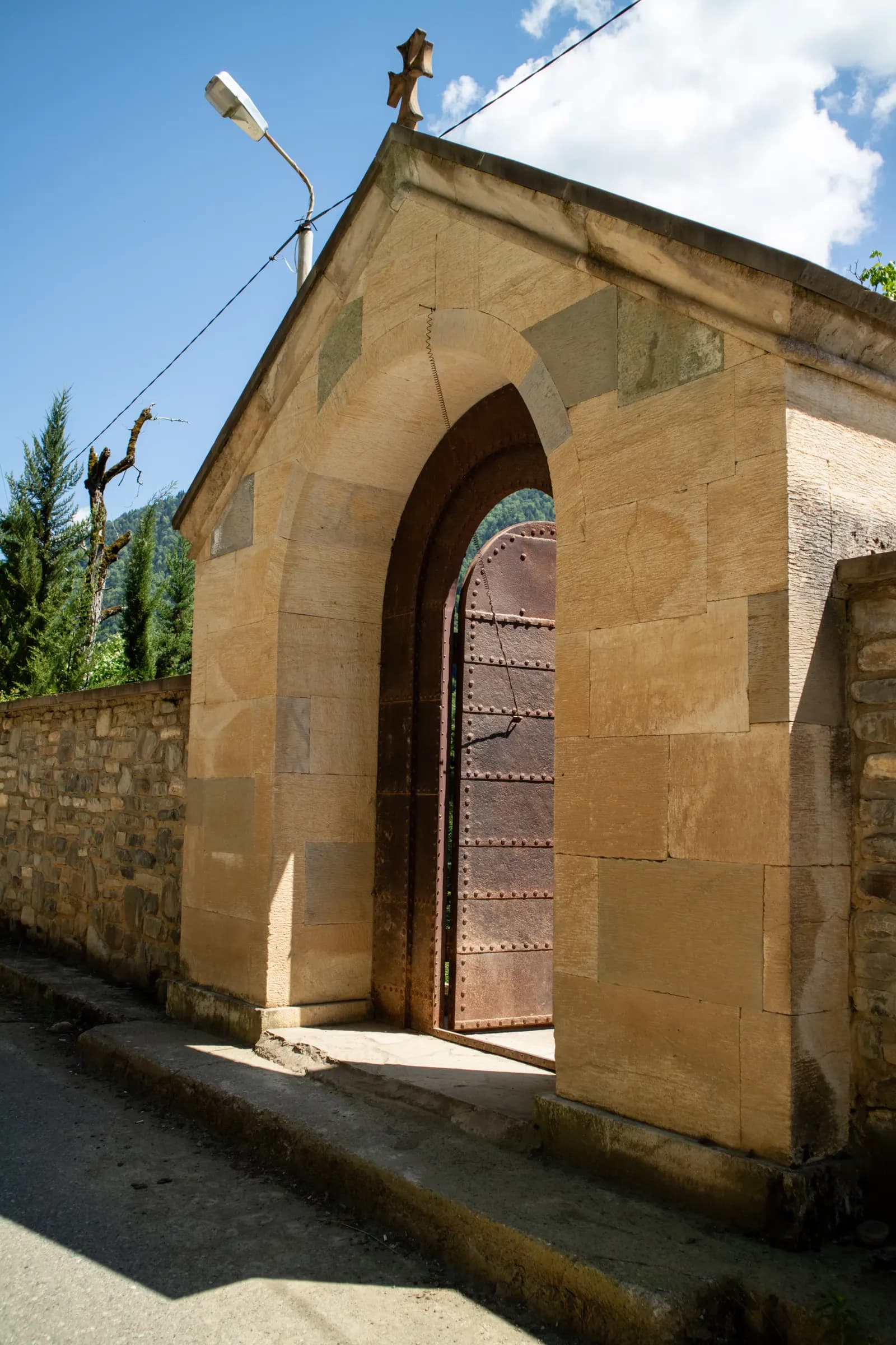
Skhalta monastery
Rugged paths and pine forest down to a 13th-century monastery, with big mountain views the whole way.
Time
4-6 h
Difficulty
Medium
Climbing
607 m
Start
Upper exit of the camp
The walk
A long walk to the ancient Skhalta monastery, tucked deep in the mountains. It starts on rugged mountain paths, winds through dense forest, and opens onto a new view at almost every turn.
Be ready for the return: the trail becomes steep on the way back to the glamping, so allow extra time for that part rather than rushing it. If you would rather not walk back uphill, you can hike down to the monastery and rent our taxi for the return. Ask our managers about that option before you go. Below we also offer variations of this route, if you are ready for a more challenging and longer hike.
What you get
- A well-preserved medieval monastery with frescoes from the 14th-15th centuries, restored in the 1990s
- Pine forest, a fern field and a stunning green hill
- A water spring to drink at, and a shop for snacks and ice cream near the end
- Yellow trail markers the whole way, and phone signal throughout
Step by step
Set out from the glamping through the upper exit and go to the right on the road. It soon becomes a forest road down to a village.
Leave the village to the right and stay on the same road until you reach a fork with a yellow sign. Take the left path.
Go straight to the next fork and yellow sign, which again directs you left, into the forest.
The road becomes a lovely green path along a picturesque fence and leads into the forest. On a sunny day the scent of pine trees is incredible.
You come to a newly constructed road that might be muddy. Be sure your footwear can handle it.
The trail ends in a fern field, beautiful in summer and vibrant during autumn. Though the path seems to end here, keep going a bit further through the ferns and you will see it continues.
The green path leads you to a stunning green hill. Take your time to take photos and rest, then cross the field.
Go straight on the comfortable car road, enjoying the views and the smell of pines around you.
At the next fork, choose the right road that goes down. Be careful: the sandy path can be slippery if your boots are not suitable for hiking.
Keep following the road. You will leave the village to the right and see several turns to the left, but stay on your path. As you descend, the views of the mountains and the river below become very nice.
When you see the sign to Dzmagula, choose the road to the left and down.
You will step onto a car road. Take care, as cars can drive here quite fast, and walk along the edges.
You will reach a sign reading Skhalta Hotel. Do not follow it. Choose the left road with the water spring, where you can refresh and drink water on a hot day.
Pass the shop, where you can buy snacks, ice cream or water. Keep following the road, cross a bridge, take one more turn to the right, and you reach Skhalta monastery.
- Tago to the viewpoint. At the crossroads go left and follow a car road. This road is not visible on MAPS.ME, so go straight.
- Viewpoint to Cheri. Take a downhill dirt road and then 10 minutes on the asphalt road.
- Cheri to Skhalta. Take the asphalt and dirt road again to reach Skhalta.
Other ways to walk it
Alternative route: Cheri and Dzmagula
For the more adventurous, consider taking a different route back. Venture towards Cheri and Dzmagula, and then follow a scenic dirt road back to the glamping site. This alternative path offers new sights and experiences, adding an extra layer of excitement to your hike. You can also take the route through Dzmagula and Cheri on the way to Skhalta, rather than back.
- Tago to the viewpoint. At the crossroads go left and follow a car road. This road is not visible on MAPS.ME, so go straight.
- Viewpoint to Dzmagula. Go downhill on dirt road for about 30 minutes.
- Dzmagula to Cheri. Take a downhill dirt road for about 20 minutes, then 10 minutes on the asphalt road.
- Cheri to Skhalta. Take the asphalt and dirt road again to reach Skhalta.
Alternative route 2: the hard hike
Are you an experienced hiker willing to take on some challenges? This one is a full-day hike, with a return journey through Otsinari lake, Pachkha village and Mount Argineti. You will visit a beautiful and peaceful lake in the mountains and climb one of the highest peaks around Tago, which offers stunning panoramic views. If you want a challenge but would rather not combine so much in one day, the route to Otsinari lake is an excellent hike on its own.
- Tago to the viewpoint. At the crossroads go left and follow a car road. This road is not visible on MAPS.ME, so go straight.
- Viewpoint to Cheri. Take a downhill dirt road and then the asphalt road.
- Cheri to Skhalta. Take the asphalt and dirt road again to reach Skhalta.
- Return over Pachkha village, Otsinari lake and Mount Argineti.
Before you go
- The return to the glamping is the challenging part, as the trail becomes steep. Allow extra time, or ask our managers about renting our taxi for the way back.
- The entire path is well-marked with yellow signs. If you lose sight of these markers, you might be off-course. Your phone will keep signal throughout, so you can call us if you need help.
- Near the monastery there is a short stretch of asphalt road. Vehicles tend to speed, so stay safe by walking along the edges.
- The monastery is sometimes closed, but you can find a phone number on the door.
What to bring
Any comfortable clothing and footwear will do. On a rainy day part of the road may be muddy, while on a sunny day it may be slippery due to sand.
Open the route on your phone
komoot and AllTrails need a signal. The pins open in Organic Maps or MAPS.ME, which work offline, so download the area before you leave the wifi.
Organic Maps and MAPS.ME also show far more paths up here than the ones we have written up - old village tracks, forest roads and ridge lines - so you can put a walk together yourself.
On the route
Before you set off
Tell us where you are going
Message reception with the route and roughly when you expect to be back. We will lend you a map, check the weather with you, and send a guide if you want one.