
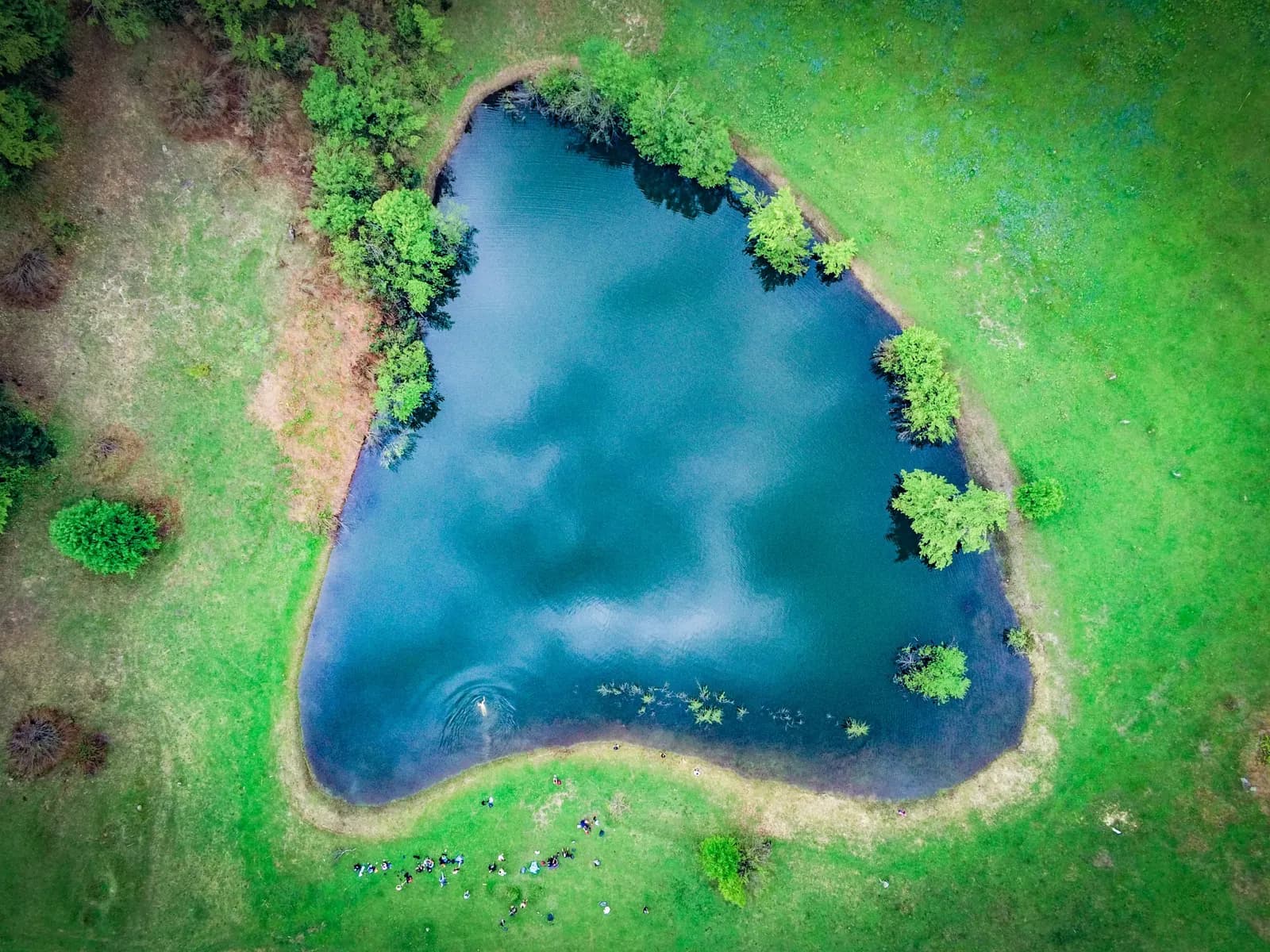
Otsinari lake
A lake that sits higher than the glamping, across stunning fields with the mountain range opposite in view.
Time
4-6 h
Difficulty
Medium
Climbing
about 597 m
High point
1,450 m
The walk
There is a beautiful hike that leads you to Otsinari lake. This lake is intriguing as it is positioned higher than the glamping site, at approximately 1,450 metres. It fills with meltwater and slightly dries up during the summer. You have the option to swim in it, but keep in mind that it is a habitat for numerous frogs and fish.
In addition to the lake, the journey to it is picturesque. You will traverse through stunning fields and behold incredible views of the mountain range on the opposite side.
The hike is not lengthy but does include some challenging sections. Particularly, the first 30 minutes are quite steep and may turn muddy after a downpour. The rest of the hike should be quite easy. You will need approximately 1 hour to 1 hour and 30 minutes one way to reach the lake.
The lake is located in the Skhalti valley, in the village of Pachkha, on Mount Otsinari. In the legend, Queen Tamar went up the mountain accompanied by her retinue. In response to the viziers' question as to where Queen Tamar was, her servants replied that she was in front of here - tsin aris, წინ არის. Both the mountain and the lake were named Otsinari.
What you get
- Stunning fields with incredible views of the mountain range opposite
- A swim in the lake, possible only until the end of June
- A lake at roughly 1,450 metres, higher than the glamping itself
Step by step
This route has no written directions
The Otsinari post is a map route rather than a set of turns, so we have not written the directions down. The map below shows two ways up, drawn from OpenStreetMap. Ask reception for a briefing before you set off, or take a guide.
- The shorter way, 4.1 km
- The longer way, 4.4 km
Before you go
- Be aware that bears inhabit these woods. While there have never been any incidents of an attack, it is always better to stay alert. If you encounter a bear, make yourself appear larger and create a lot of noise.
- Due to the presence of bears, we advise against undertaking this hike alone.
- The first 30 minutes are quite steep and may turn muddy after a downpour.
- Swimming is possible only until the end of June, after which the lake dries up.
- Use MAPS.ME or Organic Maps for this route. Other maps do not have it.
- If you find yourself lost or in need of assistance, you can always reach us on WhatsApp or by calling us directly.
Open the route on your phone
komoot and AllTrails need a signal. The pins open in Organic Maps or MAPS.ME, which work offline, so download the area before you leave the wifi.
Organic Maps and MAPS.ME also show far more paths up here than the ones we have written up - old village tracks, forest roads and ridge lines - so you can put a walk together yourself.
On the route
Before you set off
Tell us where you are going
Message reception with the route and roughly when you expect to be back. We will lend you a map, check the weather with you, and send a guide if you want one.